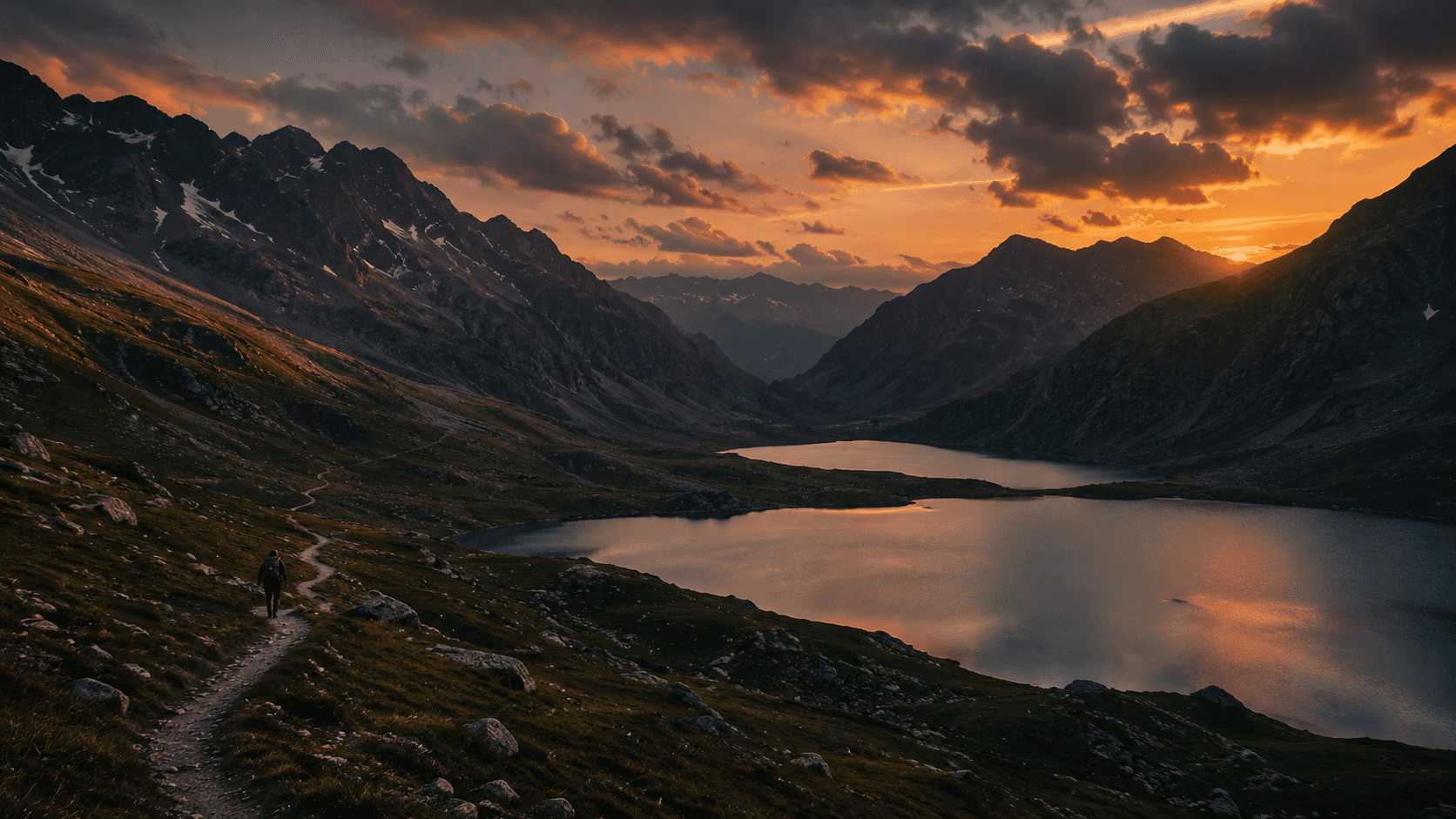
Tarsar Marsar
Twin alpine lakes famous for their breathtaking high-altitude trek.
Duration
7 Days
Distance
48 - 50 Km
Max Elevation
4,100 m (13,450 ft)
Starting Point
Aru Valley (2,400 m)
Difficulty
Moderate to Challenging
Best Time
June - September
Average Temp
12°C - 20°C (Day), 0°C - 5°C (Night)
Mobile Network
None beyond Aru
The Soul of Kashmir
The Kashmir Valley, frequently extolled as a paradisiacal enclave in the western Himalayas, possesses a topography shaped by intense tectonic upliftment and glaciation dating back to the Pleistocene-Holocene epochs. Within this rugged and breathtaking landscape lies the Tarsar Marsar Trek, widely regarded by mountaineers and geographers as one of the most aesthetically profound alpine journeys in the Indian subcontinent. Nestled primarily within the Anantnag and Pulwama districts, this trek offers a multi-day expedition into the heart of the Pir Panjal and Himalayan mountain ranges.
The lakes of Tarsar and Marsar are deeply embedded in regional folklore and are often referred to as the "twin sisters" due to their close geographic proximity and similar physical characteristics. Separated by a towering mountain ridge with a peak elevation exceeding 4,000 meters, the two lakes are bound together not only by geography but by Kashmiri cultural mythology. Local legends describe them as ghost sisters whose moods dictate the unpredictable weather of the high-altitude basins. The romantic allure of these water bodies was immortalized in the sixteenth century by the Kashmiri ruler Yusuf Shah Chak, who wrote: "When I remember the two tresses of the comely beloved, Tears begin to flow from my eyes like streams from Tarsar and Marsar".The lakes of Tarsar and Marsar are deeply embedded in regional folklore and are often referred to as the "twin sisters" due to their close geographic proximity ...
The Three Sisters
Tarsar Lake
Situated at an altitude of approximately 3,795 meters, Tarsar is an almond-shaped basin measuring roughly two kilometers in length. It is highly exposed to sunlight, which interacts with the mineral-rich glacial water to produce a mesmerizing optical effect. The lake visibly changes color throughout the day, shifting from turquoise green to deep quartz blue depending on the angle of solar incidence and cloud cover.
Marsar Lake
Resting at a slightly higher elevation of around 3,945 meters, Marsar is perennially shrouded in mystery and mist. Known in local parlance as the "killer lake" (where "mar" translates to kill and "sar" to lake), Marsar is tucked beneath a steep, overhanging cliff that drops nearly 1,000 feet into the valley below. The topographical funneling of air currents causes Marsar to frequently play hide-and-seek behind thick curtains of clouds, rendering clear viewings a rare privilege.
Sundersar Lake
A third, slightly smaller water body, Sundersar Lake, serves as a crucial geographical interlude between the two sisters. Nestled at approximately 3,950 meters, Sundersar is a serene, circular basin framed by lush meadows and a carpet of yellow wildflowers during the peak summer months.
Biodiversity
Flora
Below 2,600 meters, deciduous forests comprising walnut, Indian horse-chestnut, and bird cherry dominate. Between 2,600 and 3,000 meters, the trail enters dense coniferous forests (blue pine and silver fir). Advancing higher, the landscape transitions into birch forests before yielding to alpine scrub and vast rolling velvet meadows (Margs), carpeted with blue poppy, geum, gentian, and potentilla in the summer.
Fauna
The sanctuary and adjoining Dachigam National Park constitute critical habitats for endangered species. Notable mammals include the critically endangered Kashmir Stag (Hangul), Himalayan Brown Bear, Snow Leopard (elusive), and Golden Marmot. Avifauna includes Himalayan Golden Eagles, Lammergeyers, Bar-headed Geese, and Koklass Pheasants.
Nomadic Heritage
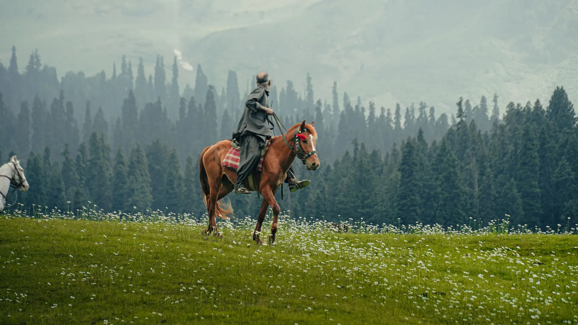
Throughout the lower and middle elevations, trekkers encounter the Gujjar and Bakarwal communities. These nomadic tribes practice a rigorous form of transhumance, migrating annually across the Pir Panjal passes. They construct temporary mud-and-timber dwellings known as Kothas or Dhokas across the meadows, offering a glimpse into a symbiotic relationship with the harsh mountain environment.
The Itinerary
Srinagar to Aru Valley
Arrive in Srinagar and embark on a scenic drive toward the Pahalgam district. The route flanks the saffron fields of Pampore, historic ruins at Avantipora, and vast apple orchards, culminating at the Aru Valley. Aru acts as the gateway to numerous alpine expeditions, an idyllic hamlet featuring undulating grasslands and traditional wooden cottages.
Aru Valley to Lidderwat
The physical trek formally begins with a gradual ascent following the upstream flow of the Lidder River. The trail meanders under the dense canopy of ancient cedar, pine, and fir trees, offering shade and a gradual introduction to the terrain. The day concludes at Lidderwat, a verdant clearing situated at 9,150 feet where streams from the Kolahoi Glacier converge.
Lidderwat to Shekwas
Departing Lidderwat, the trail initiates a critical ecological transition. As altitude is gained, the thick coniferous forests thin out, replaced by silver birch. Eventually, the trail leaves the timberline behind entirely, yielding to the vast, rolling velvet meadows of Shekwas. The panoramic views of the surrounding Himalayan peaks expand dramatically here.
Shekwas to Tarsar Lake
A relatively short but demanding hike leads to the trek's crown jewel. Following the upstream flow of the Tarsar river, the emerald expanse of Tarsar Lake reveals itself, wedged between towering snow-clad ridges. Uniquely, the topography permits pitching tents directly on the grassy shoreline, an extreme rarity in Himalayan trekking.
Tarsar Lake to Sundersar
Leaving Tarsar requires trekkers to scale the steep Sonamous (or Tarsar) Pass, crossing the 12,960-foot ridge that encircles the lake. The descent into the Zachmargi valley presents unparalleled alpine vistas. The route passes through lush grasslands, concluding at Sundersar Lake, a smaller but equally stunning alpine body.
Sundersar to Marsar to Homwas
An early start is imperative to ascend the Marsar ridge, peaking at over 13,200 feet. Trekkers observe the elusive Marsar Lake from a sheer cliff edge nearly 1,000 feet above the water. Following the viewing, the route diverts into a steep descent through the valley toward the Homwas campsite, re-entering the warmer, oxygen-rich lower altitudes.
Homwas to Aru to Srinagar
The final leg involves a 13-kilometer continuous descent through the Jagmargi valley. The trail re-enters the thick treeline at Lidderwat, retracing the initial path along the Lidder River back to the Aru Valley. Upon reaching Aru by late afternoon, vehicles transport trekkers back to Srinagar.
Read Detailed Article
Tarsar Marsar Trek: Geographical, Ecological, and Cultural Master Guide
The Kashmir Valley, frequently extolled as a paradisiacal enclave in the western Himalayas, possesses a topography shaped by intense tectonic upliftment and glaciation dating back to the Pleistocene-Holocene epochs, originating from the ancient Tethyan Geosyncline. Within this rugged and breathtaking landscape lies the Tarsar Marsar Trek, widely regarded by mountaineers and geographers as one of the most aesthetically profound alpine journeys in the Indian subcontinent.
Nestled primarily within the Anantnag and Pulwama districts of Jammu and Kashmir, this 7-day expedition traverses the heart of the Pir Panjal and Himalayan mountain ranges. The trail serves as a masterclass in high-altitude geographical transitions, winding through dense coniferous forests, expansive alpine meadows, and stark glacial basins, ultimately leading to a triad of pristine, high-altitude lakes: Tarsar, Marsar, and Sundersar.
1. Geography, Hydrology, and Folklore
The Folklore of the "Twin Sisters"
The lakes of Tarsar and Marsar are deeply embedded in regional folklore and are often referred to as the "twin sisters" due to their close geographic proximity and similar physical characteristics. Separated by a towering mountain ridge with a peak elevation exceeding 4,000 meters, the two lakes are bound together by Kashmiri cultural mythology.
Local legends describe them as ghost sisters whose moods dictate the unpredictable weather of the high-altitude basins. The romantic allure of these water bodies was immortalized in the sixteenth century by the Kashmiri ruler Yusuf Shah Chak, who invoked their beauty in poetry dedicated to his beloved, writing:
"When I remember the two tresses of the comely beloved,
Tears begin to flow from my eyes like streams from Tarsar and Marsar."
Hydrological Profile of the Lakes
The focal points of the expedition are the oligotrophic lakes of Tarsar and Marsar. Oligotrophic lakes are characterized by low primary productivity and low algal production, resulting in exceptionally clear water of pristine, potable quality. Both lakes are fed directly by the glacial meltwaters of the Kolahoi mountain massif, which lies approximately twenty kilometers to the east. Despite their shared origins, the lakes exhibit a fascinating hydrological and atmospheric dichotomy:
- Tarsar Lake (3,795 m): An almond-shaped basin measuring roughly 2 km in length and 0.8 km in width. Highly exposed to sunlight, the mineral-rich glacial water produces a mesmerizing optical effect, shifting from turquoise green to deep quartz blue depending on the angle of solar incidence and cloud cover. The outflow drains eastward into the Lidder River via Lidderwat, cementing its connection to the Pahalgam valley.
- Marsar Lake (3,945 m): Resting at a slightly higher elevation, Marsar is perennially shrouded in mystery and mist. Known in local parlance as the "killer lake" (mar translates to kill and sar to lake), Marsar is tucked beneath a steep, overhanging cliff that drops nearly 1,000 feet into the Dachigam valley. The topographical funneling of air currents causes Marsar to frequently play hide-and-seek behind clouds, rendering clear viewings a rare privilege. The meltwater from Marsar forms the Dagwan Nallah, flowing westward through the Dachigam Valley, entering Srinagar near Harwan Garden, and acting as the primary source of the famed Dal Lake.
- Sundersar Lake (3,950 m): A smaller, serene, circular basin framed by lush meadows and a carpet of yellow wildflowers during the peak summer months. It serves as a crucial geographical interlude between the two larger lakes, and is used as a staging ground before the final push to view Marsar.
Biodiversity and the Overa-Aru Sanctuary
The trekking route predominantly traverses the Overa-Aru Wildlife Sanctuary, a protected area sprawling across 511 square kilometers in the Lidder Forest Division. Originally declared a game reserve in 1945 under Dogra Rule, it was officially upgraded to a sanctuary in 1981 to protect its fragile catchments and rare species. The sanctuary exhibits distinct altitudinal zonation:
- Below 2,600 meters: Deciduous forests comprising walnut (Juglans regia), Indian horse-chestnut (Aesculus indica), and bird cherry (Padus cornuta).
- 2,600 to 3,000 meters: Dense coniferous forests consisting primarily of blue pine on dry soils and silver fir (Abies pindrow) on moister grounds.
- 3,000 to 3,500 meters: Birch forests (Betula utilis or Bhoj trees).
- Above 3,500 meters: Alpine scrub (Juniperus spp.) and vast, rolling velvet meadows (Margs) carpeted with blue poppy, geum, gentian, and potentilla.
Fauna Conservation Status
| Taxonomic Category | Notable Species Observed in Overa-Aru | Conservation Status / Ecological Notes | | :--- | :--- | :--- | | Mammals | Kashmir Stag (Hangul) | Critically endangered; primarily found in the Dachigam-Overa corridor. | | | Himalayan Brown Bear | High-altitude omnivore; drawn to alpine flora and glacial valleys. | | | Asiatic Black Bear | Found in the lower, forested sections of the sanctuary. | | | Snow Leopard | Apex predator of the upper alpine zones; extremely elusive. | | | Kashmir Musk Deer & Serow | Inhabit the steep, rocky slopes and sub-alpine scrub forests. | | | Golden Marmot | Frequently spotted basking on rocks near the high-altitude lakes. | | Avifauna | Himalayan Golden Eagle & Lammergeyer | High-flying raptors that patrol the ridges above Tarsar and Marsar. | | | Bar-headed Geese | Migratory breeding colonies establish themselves near the lakes in summer. | | | Koklass Pheasant & Monal | Vibrant ground-dwelling birds found in the coniferous and birch forests. |
2. Detailed Day-by-Day Expedition Itinerary
The standard Tarsar Marsar Trek spans 7 days, covering an approximate distance of 48 to 50 kilometers in a circular or "lasso" configuration. The journey commences and concludes at the Aru Valley base camp.
| Trek Day | Segment Description | Distance | Approx. Duration | Start Altitude | End Altitude | | :---: | :--- | :---: | :---: | :---: | :---: | | Day 1 | Srinagar to Aru Valley (Vehicle Transit) | 112 km | 3-4 hrs | 1,585 m | 2,400 m | | Day 2 | Aru Valley to Lidderwat | 10-11 km | 6-7 hrs | 2,400 m | 2,800 m | | Day 3 | Lidderwat to Shekwas | 6 km | 5 hrs | 2,800 m | 3,350 m | | Day 4 | Shekwas to Tarsar Lake | 4-5 km | 4-5 hrs | 3,350 m | 3,800 m | | Day 5 | Tarsar Lake to Sundersar | 6 km | 5 hrs | 3,800 m | 4,000 m | | Day 6 | Sundersar to Marsar to Homwas | 9-11 km | 7 hrs | 4,000 m | 3,500 m | | Day 7 | Homwas to Aru to Srinagar | 13 km | 6-7 hrs | 3,500 m | 2,400 m |
Day 1: Arrival and Transit to Aru Valley
Trekkers assemble in Srinagar and commence a scenic 112-kilometer drive toward Pahalgam. The route flanks the saffron fields of Pampore, historic ruins at Avantipora, and vast apple orchards, culminating at the Aru Valley. Aru acts as the gateway to numerous alpine expeditions. It is an idyllic hamlet featuring undulating grasslands, the convergence of the Naphran Nallah and the Lidder West River, and traditional wooden cottages. Trekkers check into local guesthouses or set up their first camp beside the river to acclimatize.
Day 2: Into the Canopy toward Lidderwat
The physical trek begins with a gradual, yet lengthy, 10-kilometer ascent following the upstream flow of the Lidder River. The trail meanders under the dense canopy of ancient cedar, pine, and fir trees, offering shade and a gradual introduction to the terrain. Along this route, trekkers encounter local Gujjar herdsmen and their rustic mud-and-wood huts. The day concludes at Lidderwat, a verdant clearing situated at 9,150 feet where the streams from the Kolahoi Glacier and Tarsar converge.
Day 3: Crossing the Treeline to Shekwas
Departing Lidderwat, the trail features a moderate to steep ascent for the first hour, initiating a critical ecological transition. As altitude is gained, the thick coniferous forests thin out, replaced by silver birch (Bhoj trees). Eventually, the trail leaves the timberline behind entirely, yielding to the vast, rolling velvet meadows of Shekwas. The panoramic views of the surrounding Himalayan peaks expand dramatically. An optional short detour from the Shekwas campsite leads to the small but charming Jadar Lake.
Day 4: The Tarsar Reveal
A relatively short but demanding hike leads to the trek's crown jewel. The route follows the upstream flow of the Tarsar river, requiring careful navigation as the terrain shifts from soft meadows to rocky boulder moraines. After approximately four hours of steady uphill trekking, the emerald expanse of Tarsar Lake reveals itself, wedged between towering snow-clad ridges. Uniquely, the topography permits pitching tents directly on the grassy shoreline, an extreme rarity in Himalayan trekking.
Day 5: Navigating the Ridges to Sundersar
Leaving Tarsar requires trekkers to scale the steep Sonamous (or Tarsar) Pass, crossing the 12,960-foot (3,950 m) ridge that encircles the lake. This hour-long ascent tests cardiovascular endurance, but the subsequent descent into the Zachmargi valley presents unparalleled alpine vistas. Following shepherd trails and winding streams, the route passes through lush grasslands and grazing pastures, concluding at Sundersar Lake, where camp is established at 13,000 feet.
Day 6: The Mysterious Marsar and Descent to Homwas
An early start is imperative as the trail ascends from Sundersar to a high-altitude saddle on the Marsar ridge, peaking at over 13,200 feet (~4,100 m). Because Marsar is nested deep in a glacial bowl, trekkers observe it from a sheer cliff edge nearly 1,000 feet above the water. Due to volatile microclimates, high winds, and heavy mist, viewing windows are often brief. Following the viewing, the route diverts down a steep descent through the Jagmargi valley toward the Homwas campsite, re-entering warmer, oxygen-rich lower altitudes.
Day 7: Final Descent to Aru & Srinagar
The final leg involves a 13-kilometer continuous descent through the valley. The trail re-enters the thick treeline at Lidderwat, retracing the initial path along the Lidder River back to Aru. Upon reaching Aru by late afternoon, vehicles transport the trekking parties back to the urban confines of Srinagar, concluding the expedition.
Key Waypoints & Coordinates
- Aru Valley (Basecamp): 34.0908° N, 75.2633° E | Elevation: 2,400 m
- Lidderwat Campsite: ~34.06° N, ~75.24° E | Elevation: 2,800 m
- Shekwas Valley: ~34.07° N, ~75.24° E | Elevation: 3,350 m
- Tarsar Lake: 34.1406° N, 75.1483° E | Elevation: 3,795 m
- Sundersar Lake: ~34.144° N, ~75.138° E | Elevation: 4,000 m
- Marsar Lake: 34.1439° N, 75.1100° E | Elevation: ~3,945 m
- Homwas Campsite: ~34.13° N, ~75.10° E | Elevation: 3,500 m
Alternate Routes and Variants
- Sonamarg Exit (Sonamais Pass): Instead of returning to Aru, an alternate 7–8 day route continues from Homwas over the Sonamais Pass (4,000 m) into Sindh Valley, exiting via Sumbal or Sonamarg (~60 km total).
- Basmai Pass Route: This variant starts at Gagangir (near Sonamarg), goes over Basmai Pass into Lidder Valley, connects to Tarsar, and rejoins the standard path. This is longer and steeper, requiring 8+ days.
3. Preparation, Fitness, and Gear Specifications
The Tarsar Marsar Trek is universally classified by mountaineering agencies as "Moderate" to "Moderately Challenging" (a Level 4 on the Bikat Rating Scale). While the route does not demand technical mountaineering skills, ice axes, or ropes under normal summer conditions, it imposes significant physiological demands due to long daily walking distances and continuous high-altitude exposure.
Fitness Metrics & Acclimatization
Adequate cardiovascular endurance and muscular stamina are non-negotiable prerequisites. Expert guidelines stipulate that prospective trekkers should meet the following benchmarks:
- Running: Capable of jogging a 5-kilometer distance in under 33 to 35 minutes, or a 10-kilometer distance in 75 minutes.
- Cycling: Ability to cycle 15 kilometers in 45 minutes without undue cardiovascular stress.
- Backpack Load: Conditioned to bear 10 to 12 kg of weight over uneven terrain (or a 3-5 kg daypack if using offloading services).
- Body Mass Index (BMI): A range between 18.5 and 28 is strongly recommended; individuals falling outside this spectrum face heightened risks of severe fatigue, joint stress, and altitude-related complications.
Acute Mountain Sickness (AMS) Protocol
The risk of AMS is a tangible concern, particularly on Days 4 through 6 when the camps are situated above 3,500 meters. Proper acclimatization strategies are critical:
- Pacing: Maintain a slow, rhythmic, methodical walking pace (the "local guide shuffle").
- Hydration: Drink 3 to 4 liters of water daily. Hydration aids the blood in carrying oxygen.
- Elevation Profile: The itinerary is specifically designed to enforce a gradual altitude profile, utilizing Lidderwat and Shekwas as vital acclimatization stepping stones before reaching the lakes.
- Emergency Meds: Carry Diamox (acetazolamide) under medical advice. Monitor blood oxygen levels daily using oximeters.
Climatology & Seasonality (Best Time to Visit)
The meteorological dynamics of the Kashmir Valley offer a distinct advantage over other Himalayan regions in India. The towering Pir Panjal mountain range acts as a formidable geographic barrier, intercepting the heavy monsoon clouds advancing from the Indian plains. Consequently, Kashmir resides in a rain shadow, receiving only light, intermittent showers rather than the torrential downpours that render treks in Uttarakhand and Himachal Pradesh hazardous during the summer monsoon.
This climatic anomaly establishes the optimal window for the Tarsar Marsar Trek from early July through the end of September.
| Month | Avg. Daytime Temp | Avg. Nighttime Temp | Environmental Characteristics | | :--- | :---: | :---: | :--- | | July | 15°C to 20°C | 0°C to 5°C | Trails fully open. Lush green valleys and residual snow patches present near high passes. Occasional light rain showers. | | August | 15°C to 20°C | 0°C to 4°C | Peak ecological bloom. Meadows carpeted with blue poppies, primulas, and wildflowers. Clear skies with afternoon mists. | | September | 10°C to 15°C | -3°C to -5°C | Autumnal transition. Greens yield to amber and rust-red. Clearest mountain views, but significantly colder nights requiring heavy thermals. |
Note: Heavy winter snow (November to April) closes the high passes, and the lakes freeze solid, making the trek completely inaccessible during winter.
Essential Gear & Packing Specifications
| Gear Category | Essential Items and Specifications | Rationale for Tarsar Marsar Environment | | :--- | :--- | :--- | | Backpacks | 50-60L main pack with rain cover; 20-30L daypack (if offloading). | Must withstand heavy rain and abrasion from rocky trails and horse-mules. | | Footwear | Waterproof trekking boots with deep rubber lugs; 4-5 pairs of wool socks. | Ankle support is mandatory for the boulder moraines near Tarsar and the steep descent from Marsar. | | Layering | Moisture-wicking base layers (merino wool); 2 fleece mid-layers; Insulated down jacket (-5°C rating). | Temperatures drop to sub-zero levels at Tarsar and Sundersar camps; layering prevents hypothermia. | | Outer Shell | High-quality waterproof hardshell jacket and waterproof over-trousers. | Afternoon thunderstorms are frequent above the treeline and on the Sonamous pass. | | Accessories | UV-protection sunglasses, wide-brimmed hat, warm beanie, trekking gloves, neck gaiter (Buff). | UV radiation is intense above 3,500m; extremities must be protected from biting winds. | | Hardware | Trekking poles (at least one), headlamp with extra batteries, reusable water bottles/hydration pack. | Poles reduce knee strain by 20% on steep descents; headlamps are essential as camps lack electricity. | | Miscellaneous | Personal medical kit, energy bars/ORS, biodegradable toiletries, high-capacity power bank (10,000 mAh+). | Off-grid environments require self-sufficiency for minor injuries and device charging. |
4. Culture, Nomads, Wazwan, and Logistical Guide
The Tarsar Marsar Trek is not merely an exercise in physical endurance; it operates as a direct conduit into the deeply ingrained cultural, historical, and culinary traditions of the Kashmir Valley.
Nomadic Pastoralists: The Gujjars and Bakarwals
Throughout the lower and middle elevations of the trek, particularly near Aru, Lidderwat, and Shekwas, trekkers encounter the Gujjar and Bakarwal communities.
- Origins & Identity: The Bakarwals (derived from the words bakari meaning goat/sheep, and wal meaning caretaker) are a Sunni Muslim nomadic tribe recognized as a Scheduled Tribe. Historically linked to the ancient "Gujjar Ratha" kingdom (5th to 11th centuries), they maintain a distinct ethno-linguistic identity, speaking the Gojri dialect.
- Transhumance lifestyle: They practice transhumance, migrating annually across the Pir Panjal passes. They move their massive herds from the low-altitude plains of Jammu in winter to high-altitude pastures (Margs) in summer.
- Kothas & Dhokas: Across the high meadows, they construct temporary mud-and-timber dwellings. Their traditional lifestyle showcases a profound, symbiotic relationship with the harsh mountain environment. They are incredibly hospitable, often sharing traditional teas and guiding lost hikers.
The Kashmiri Culinary Heritage
Kashmiri cuisine is a heavily spiced, slow-cooked amalgamation of Mughal, Persian, and Central Asian influences. While meals during the trek are kept lightweight, vegetarian, and highly caloric, trekkers can experience these culinary traditions before and after the trek in Srinagar or Pahalgam.
The Ceremonial Wazwan
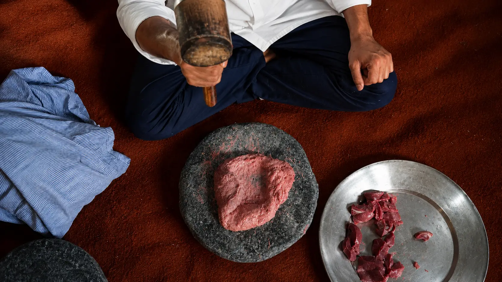
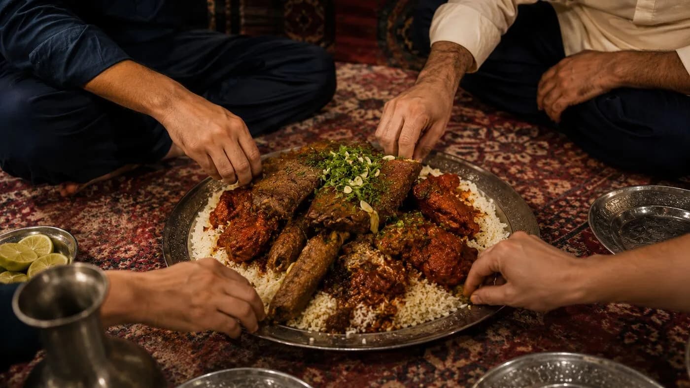
The zenith of Kashmiri gastronomy is the Wazwan, a multi-course feast consisting of up to 36 courses, prepared by master chefs known as Vastas or Wazas. Eaten communally from a large, hand-carved copper platter called a trami, the feast highlights slow-cooked lamb and rich yogurt gravies:
- Rogan Josh: Tender lamb braised in a vivid, aromatic gravy of Kashmiri chilies, cockscomb flower, fennel, and dried ginger.
- Tabak Maaz: Crispy, shallow-fried rib racks simmered in milk and spices before frying.
- Gushtaba: Spongy, hand-pounded meatballs simmered in a complex, velvety, yogurt-based gravy (Yakhni).
- Nadru Yakhni: Lotus stems cooked in a delicate, spiced yogurt sauce.
- Dum Aloo: Slow-cooked whole potatoes in a rich yogurt and fennel-heavy red gravy.
Saffron Kahwa and Pink Noon Chai
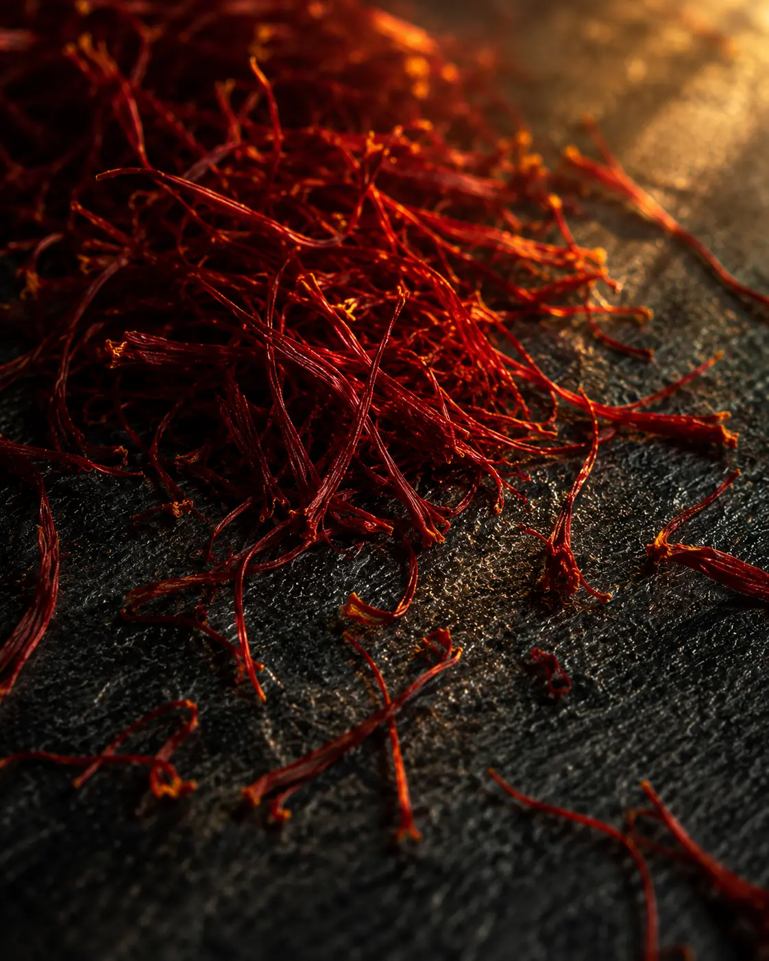
- Kahwa: A golden, fragrant green tea infused with Kashmiri saffron strands, green cardamom, cinnamon, and crushed almonds, traditionally brewed in a copper samovar. It is highly thermogenic, providing instant warmth.
- Noon Chai (Sheer Chai): A distinctive, savory pink tea. The unique hue is achieved by boiling gunpowder green tea leaves with a pinch of baking soda, followed by adding milk and salt. Consumed at breakfast with local breads like Girda (round, tandoor-baked bread), Lavasa (thin flatbread), or flaky Bakarkhani procured from a local baker (Kandur), Noon Chai provides essential sodium to prevent dehydration during high-altitude exertion.
Logistical & Administrative Guide
Executing the Tarsar Marsar Trek requires detailed administrative coordination.
Transportation and Accessibility
- Srinagar Hub: Fly into Sheikh-ul-Alam International Airport (SXR). From Srinagar, travel 95-112 km (3 to 4 hours) to Pahalgam.
- Union Taxi Regulations: Pahalgam operates under strict local taxi union rules; outside commercial vehicles or private Srinagar taxis are not permitted to travel to the interior base camp. Trekkers must hire local union taxis in Pahalgam for the final 12 km (45 minutes) drive to the Aru Valley base camp.
Permits, Security, and Bureaucracy
- Communication: Prepaid SIM cards from other Indian states instantly lose signal upon entering Jammu & Kashmir. Only postpaid connections (Jio, Airtel, BSNL) work. There is no signal past Aru.
- Forest & Wildlife Permits: Entry into the Overa-Aru Wildlife Sanctuary requires clearance and entry fees from the Forest and Wildlife Departments, obtainable at checkpoints in Pahalgam or Aru.
- Police Registration: Government-issued photo identification (Aadhaar, Passport, or Driver's License) must be submitted to local police checkposts. Foreign nationals may require additional permits.
- Medical Certificate: A certified medical fitness document verifying blood pressure, heart rate, and overall fitness is mandatory to process trekking permits in Kashmir.
Financial Parameters & Operator Comparison
Comprehensive packages from established operators range from ₹12,000 to ₹18,000 per person. This typically includes Srinagar-to-Srinagar transport, all camping equipment, meals, mules for central luggage, and guide fees.
- Offloading: Mules to carry a personal backpack cost approximately ₹2,800 to ₹3,500 total.
- Independent Budget: Self-supported trekkers hiring local guides and porters directly in Aru can suppress costs to ₹6,000 to ₹8,000, though this requires extreme logistical self-sufficiency.
| Operator (Sample) | Days | Trek Dist. | Altitude Range | Inclusions | Avg. Cost (INR) | | :--- | :---: | :---: | :---: | :--- | :---: | | Pahalgam Walks & Treks | 7 | ~50 km | 2,400–4,100 m | Tents, all meals, guide, permits, transport, horses, camp gear | ₹14,000 | | Trek The Himalayas | 7 | ~55 km | 2,400–4,100 m | Accommodations, meals, permits, transport, guide, central mules | ~₹14,500 | | Climb Kashmir | 7 | ~55 km | 2,400–4,100 m | Group gear, guide, local permits, meals, camping fees | ₹15,500 |
Safety, Environment, and Sustainability
The remoteness of the trail past Aru necessitates strict safety and ecological protocols:
- Leave No Trace: The fragile oligotrophic nature of the lakes means any pollutants could trigger irreversible eutrophication. Trekkers must carry out all inorganic waste.
- Water Safety: Washing clothes, utensils, or bathing directly in streams or lakes is strictly prohibited. Single-use plastic bottles are discouraged; use filtration or boiled water.
- Campsite Buffer: Tents must be pitched at least 60 meters away from water sources (with the exception of the designated Tarsar shoreline campsite). Human waste must be managed using deep-pit toilet tents that are fully filled and naturalized before moving.
- Wildlife Protocol: Himalayan brown bears, black bears, and leopards inhabit the area. Hike in groups, avoid walking during twilight hours, and never store food inside sleeping tents.
Safety & Prep
Physical Preparation
Adequate cardiovascular endurance and muscular stamina are non-negotiable prerequisites. You should be capable of jogging 5km in under 35 minutes or cycling 15km in 45 minutes. A BMI between 18.5 and 28 is strongly recommended.
Acute Mountain Sickness (AMS)
The risk of AMS is tangible above 3,500 meters. Proper acclimatization strategies are critical: slow ascents, hyper-hydration (3-4 liters daily), and avoiding rapid elevation gains. Lidderwat and Shekwas act as vital acclimatization stepping stones.
Leave No Trace
The fragile oligotrophic nature of the lakes means any introduction of pollutants could trigger irreversible eutrophication. Trekkers must carry out all inorganic waste, use strictly biodegradable toiletries, and pitch tents at least 60 meters away from water sources (except at Tarsar shoreline).
Need help planning this trek?
Let Waza AI build your personalized itinerary, check permit requirements, and suggest the best local guides for the Tarsar Marsar expedition.